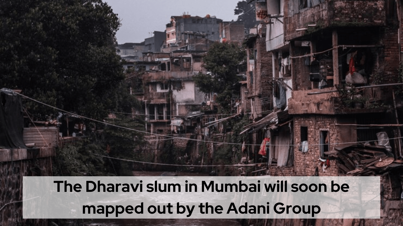
Dharavi, one of the biggest slums in Asia, is located in the middle of Mumbai. As part of their massive revitalization project in India’s financial city, the Adani Group is set to begin mapping the area in the following weeks.
According to the initial procurement papers, the master plan for Dharavi, which Adani plans to submit to the local authorities in March 2024 (a little later than the scheduled December deadline), is intended to be partly shaped by the survey results.
The Economic Times reports that local business Genesys International Ltd. will be responsible for the mapping. At the same time, Buro Happold Ltd., a consultant located in the UK, will handle the physical infrastructure requirements. Sasaki Associates Inc., a firm based in Boston, will supervise the entire makeover.
The cutting-edge Oyster 3D Maps platform from Genesys, known for its accuracy and inventiveness, is going to be pivotal to the Adani Dharavi endeavour.
Revitalization of Dharavi
After first being proposed in 2004, the Dharavi Redevelopment Project (DRP) has since achieved considerable progress.
Dharavi, the largest slum in Asia, is located on 240 acres of valuable property in the middle of Mumbai, the commercial city of Maharashtra, and the government put out a worldwide competition for its reconstruction in October 2022.
The Adani Group placed the highest offer of Rs. 5,069 crore, over the base price of Rs 1,600 crore, for the reconstruction of Dharavi, a slum cluster in Mumbai and one of the biggest in the nation, in November 2022.
Adani Reality will rehabilitate more than 56,000 households during the seven-year timeframe specified in the redevelopment agreement. An estimated 23,000 crore rupees would be needed to complete the project.
Why Is This Redevelopment Project Crucial?
Both Mumbai may reap substantial economic benefits from the rebuilding project.
New and current firms and commercial activities may use the plan’s industrial and business zones, which provide superior infrastructure, better facilities, and development platforms.
With a higher floor space index (FSI), buildings of Adani Dharavi may expand vertically, making more space available for various uses. Dharavi at present is stretched horizontally to accommodate the high population and has a low FSI.
In addition to being close to significant financial and commercial hubs in Mumbai, such as the Bandra Kurla Complex, Dharavi also maintains its prominent position.
The redesign will link the expansive Dharavi slums and the modern Mumbai environment.
With its new look and feel, Dharavi will make it easier for its people to blend in with the rest of the city and lessen residential segregation.
What Dharavi Means to the Adani Group?
Participation in a thorough mapping exercise in Dharavi by the Adani Group indicates their dedication to game-changing urban planning. The initiative’s overarching goal is to produce an accurate and comprehensive map of the slum using state-of-the-art technology. This will allow for better community-based development initiatives, resource allocation, and decision-making.
- Advances in Technology Piloting the Map-Making Initiative
Using cutting-edge technology is crucial to the mapping project’s success. The Adani Group intends to use a mix of ground-level surveys, GIS technology, and satellite photography to build a complete map of Adani Dharavi. By considering the place from several angles, including its physical structures and socioeconomic processes, we may get a more complete picture of it.
- Engaging the Community and Fostering Local Agency
The participation of the Dharavi people is an integral part of the Adani Group’s plan. The mapping project values Residents’ input, which acknowledges the significance of local knowledge and viewpoints. Specialists will work with local volunteers and community leaders to ensure the mapping captures the complexities of Dharavi’s distinct socio-cultural fabric.
- Building Up Infrastructure and Making the Most of Available Resources
With its meticulous blueprint, the Adani Group plans to use Dharavi as a catalyst for infrastructural development. Using the mapping project as a strategic tool for targeted interventions, important areas for development, including sanitation, water supply, and healthcare facilities, may be identified. This, in turn, helps optimize resources by ensuring that investments align with what the community really needs.
Final Thoughts
By producing a map of Adani Dharavi, the Adani Group is doing more than just depicting a slum; it is guiding the way toward more equitable and environmentally friendly city planning. Technical skills are important, but a true dedication to community empowerment, social justice, and ethical city planning is critical for the success of this endeavour. Everyone is waiting to see how the experiment develops over the next several weeks, hoping that Dharavi’s lessons influence future urbanization and turn obstacles into possibilities for a more equitable and sustainable future.